



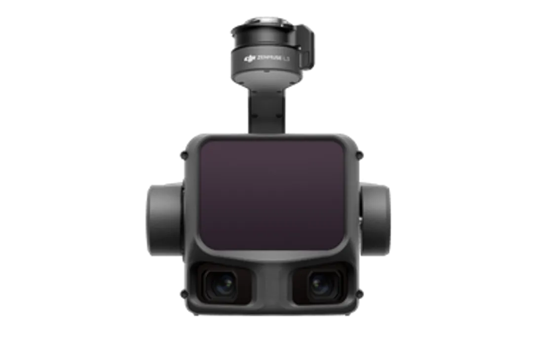
DJI Zenmuse L3 LiDAR payload enhances aerial surveying with its long-range capabilities and high-accuracy data acquisition. This advanced system integrates a 1535nm LiDAR sensor, dual 100MP RGB mapping cameras, and a high-precision POS system. These components are housed in a compact design, delivering unprecedented performance for its size. The Zenmuse L3 is designed to accelerate geospatial data collection for various industrial applications.
The system is built upon DJI’s commitment to pushing the boundaries of drone technology for enterprise use. It aims to provide professionals with tools that increase efficiency and accuracy in their operations. The Zenmuse L3 represents a significant step forward in aerial LiDAR technology, offering a blend of range, detail, and ease of use. This makes it a valuable asset for surveying, mapping, and asset management.
As reported by DJI Enterprise, the Zenmuse L3 is DJI’s first long-range, high-accuracy aerial LiDAR system. It is specifically designed for demanding professional applications where precise and extensive data is crucial. The system’s capabilities allow for daily coverage of up to 100 km², significantly boosting productivity.
The payload’s integration with platforms like the DJI Matrice 400 is key to its deployment. This combination allows for stable flight operations and optimal data capture. The development signifies DJI’s continued focus on the enterprise drone market, offering specialized solutions like the Zenmuse L3 to meet specific industry needs. The pursuit of advanced surveying tools is a critical aspect of the evolving low-altitude economy.
Advanced LiDAR Technology for Unrivaled Data Capture
The core of the DJI Zenmuse L3 is its 1535nm long-range LiDAR sensor. This powerful sensor can reach up to 950 meters, even on objects with as little as 10% reflectivity. This capability is crucial for penetrating challenging environments and capturing data from higher altitudes. Such extended range significantly reduces the number of flights required for large area surveys, thereby increasing operational efficiency. This advancement is particularly relevant for industries that require comprehensive mapping of vast terrains or complex infrastructure.
Furthermore, the LiDAR system is a Class 1 eye-safe laser, ensuring safe operation. It boasts up to 16 returns, allowing it to capture dense point clouds by detecting multiple surfaces. This feature is invaluable for surveying areas with dense vegetation or intricate structures. As detailed by Halo Robotics, the system can capture ultra-thin point clouds at high altitudes, recommended between 300–500 meters Above Ground Level (AGL). The adjustable point rates cater to various terrain types, from dense canopies to tall infrastructure.
The precision of the LiDAR data is further enhanced by a smaller spot size. At 120 meters, the spot size is Ø 41 mm, with a beam divergence of 0.25×0.25 mrad. This allows for the detection of fine details like wires and edges, which are often missed by less advanced systems. The point thickness achieved is exceptionally low, with examples showing 1–2 cm thickness and vertical RMSE tests in the 3–8 cm range, depending on altitude. This level of detail ensures high-accuracy topographic mapping and asset inspection.
Dual High-Resolution Cameras for Comprehensive Mapping
Complementing the LiDAR sensor, the Zenmuse L3 features dual 100MP RGB mapping cameras. These cameras are crucial for generating high-resolution orthomosaics and colorizing the LiDAR point clouds. The high resolution ensures that even fine details and textures are captured accurately, providing a richer dataset for analysis. This dual-camera system enhances the overall mapping capabilities, producing visually detailed and geometrically precise outputs.
The integration of RGB imagery with LiDAR data provides a comprehensive 3D model of the surveyed area. This is particularly beneficial for applications requiring both geometric accuracy and visual context. For instance, in infrastructure inspection, the colorized point clouds can help identify specific components or defects more easily. According to Tokopedia, the dual 100-megapixel Micro Four Thirds cameras are tightly integrated into the all-in-one payload. This setup ensures crisp colorized point clouds, even in scenes with low texture.
The combined horizontal field of view (FOV) for the dual RGB mapping cameras is 107°. This wide FOV allows for broader coverage in each pass. The RGB Ground Sampling Distance (GSD) averages 3 cm at a 300m nadir flight altitude, ensuring detailed imagery. This combination of high-resolution RGB data and precise LiDAR measurements makes the Zenmuse L3 a powerful tool for creating detailed 3D models and accurate maps for various industries, including urban planning, environmental monitoring, and construction.
High-Accuracy and Efficiency in Data Acquisition
The DJI Zenmuse L3 is engineered for high accuracy, ensuring that the geospatial data collected is reliable for critical decision-making. The system incorporates a high-precision POS (Positioning and Orientation) system, which includes a high-precision IMU (Inertial Measurement Unit). This combination allows for centimeter-level accuracy in data acquisition, especially when utilized with RTK (Real-Time Kinematic) positioning. This level of accuracy is vital for applications such as land surveying, infrastructure monitoring, and precision agriculture.
One of the significant advantages of the Zenmuse L3 is its rapid deployment. Unlike some other systems that require a lengthy IMU pre-heating period, the Zenmuse L3 is ready to fly almost immediately. It features automatic in-route heading, pitch, and roll calibration. This reduces downtime and allows for more efficient mission planning and execution. This feature is particularly beneficial for time-sensitive projects or for operations in remote areas where quick setup is essential.
The system’s ability to cover up to 100 km² per day is a testament to its efficiency. This is achieved through the combination of long-range LiDAR, wide camera FOV, and optimized flight planning. Such extensive coverage capability makes the Zenmuse L3 ideal for large-scale mapping projects, regional surveys, and cadastral mapping. As highlighted by DJI Enterprise, the Zenmuse L3 redefines hardware performance, integrating its advanced components into a compact device that delivers exceptional results.
Integration and Applications in the Enterprise Sector
The Zenmuse L3 is designed to integrate seamlessly with specific drone platforms, notably the DJI Matrice 400 series, which requires a dedicated single gimbal connector. This integration ensures stable flight performance and optimal data capture conditions. The payload’s weight is approximately 1.60 kg (without the single gimbal connector), and its dimensions are 192×162×202 mm (L×W×H). Power consumption is typically 64 W, with a maximum of 100 W.
The applications for the Zenmuse L3 are vast and span multiple industries. In surveying and mapping, it provides highly accurate topographic data for land development and infrastructure planning. For asset management, it allows for detailed inspections of bridges, power lines, and buildings, identifying potential issues before they become critical. The system’s ability to penetrate vegetation also makes it suitable for forestry management and environmental monitoring. This aligns with the growing need for advanced tools in the low-altitude economy.
The Zenmuse L3 also contributes to improved safety in hazardous environments. By enabling data collection from higher altitudes or from a safe distance, it reduces the need for personnel to enter dangerous areas. This is particularly relevant in sectors like mining, energy, and emergency response. The system supports end-to-end solutions, often paired with software like DJI Terra for data processing, enabling a complete workflow from flight planning to final data deliverables. This comprehensive approach ensures that users can maximize the value of the data collected, driving innovation and efficiency across the enterprise drone sector.