



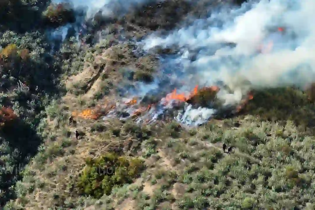
Drone for hotspot detection is rapidly transforming wildfire management by providing advanced thermal imaging capabilities that can identify hidden embers and smoldering areas often missed by traditional methods. This technology is proving crucial in preventing re-ignition and ensuring the complete extinguishment of fires, significantly enhancing the effectiveness of firefighting and post-fire monitoring efforts.
The integration of drones equipped with radiometric thermal cameras allows for precise temperature readings of the ground surface. This capability goes beyond simply detecting visible smoke or flames, enabling responders to pinpoint smoldering root systems, embers buried under debris, and potential flare-up risks. Consequently, this technology is becoming an indispensable tool for agencies tasked with protecting lives, property, and natural resources from the devastating impact of wildfires.
As fire scenarios become more complex due to climate change and expanding urban interfaces, traditional detection methods are increasingly proving insufficient. Drones offer a vital aerial perspective, overcoming limitations of visibility in smoke-filled environments, inaccessible terrain, and nighttime operations. This advancement in technology is not only improving response efficiency but also enhancing the safety of firefighters.
The deployment of these advanced drones is a complex operation requiring specialized training and adherence to strict regulations. Companies are developing comprehensive workflows, from initial mission planning and airspace authorization to flight execution and data sharing, to maximize the effectiveness of drone-based hotspot detection. This ensures that valuable data is collected and acted upon swiftly to mitigate fire risks.
Advanced Thermal Imaging for Unseen Threats
Radiometric thermal cameras mounted on drones are the cornerstone of effective hotspot detection. These cameras measure the actual surface temperature of an area, distinguishing them from simple thermal cameras that only detect heat differences. This precision allows for the identification of subtle heat signatures that indicate smoldering material beneath the surface.
As reported by Remote Robotic, these drones can detect smoldering root systems, buried embers, and re-ignition risks that ground crews and visible-light cameras would invariably miss. This capability is critical after a wildfire has been visually contained, as hidden heat sources can easily reignite and cause secondary fires, undoing all previous efforts.
The aerial perspective provided by drones is invaluable. It allows for rapid scanning of large, often inaccessible areas. This is a significant improvement over ground-based methods, which are limited in reach and can be time-consuming and dangerous to deploy. The ability to quickly assess a wide perimeter ensures that no potential hotspots are overlooked.
Specialized Training and Operational Readiness
Operating drones in emergency zones requires highly trained personnel and strict adherence to aviation regulations. Candrone, for instance, emphasizes the extensive training its wildfire drone crews undergo. This training extends far beyond basic piloting skills, encompassing crucial areas like First Aid, fire weather understanding, effective radio communication, and even basic fire suppression techniques.
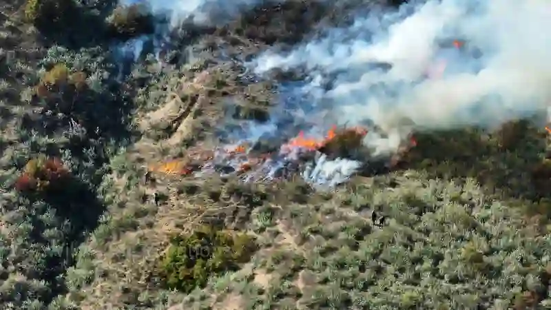
According to Candrone, operating drones in disaster zones without proper authorization is illegal and poses significant risks to manned aircraft and first responders. Therefore, every mission is conducted under strict authorization and regulatory compliance, ensuring safe and effective operations. This meticulous approach is vital for maintaining public safety and operational integrity.
Companies like Hummingbird Drones highlight their rapid response capabilities. They train their Scan Crews to Type-2 firefighting standards and equip them for remote deployment via various transport methods, including trucks, helicopters, or float planes. This ensures immediate and seamless deployment to wildfire locations, regardless of accessibility, as noted on their website.
Technological Advancements and Deployment Strategies
The deployment of drone technology for hotspot detection involves sophisticated planning and execution. The Los Angeles Fire Department (LAFD), in collaboration with DJI and Nova, has been transforming post-wildfire mop-up operations through automated thermal workflows. This involves detailed airspace planning, flight execution, and data sharing to ensure hot spots are identified quickly and reliably, even in challenging terrain.
As detailed in a DJI Enterprise Insights webinar, the process includes configuring DJI Pilot 2 and FlightHub 2 for thermal scans, processing infrared data for actionable insights, and utilizing 3D modeling and panorama capture. This integrated approach allows for rapid visualization and informed decision-making by emergency response teams.
The cost of equipping an agency with a thermal-equipped drone and training typically ranges from CAD $20,000 to $55,000, according to Remote Robotic. This investment is often justified by the potential to prevent catastrophic secondary fires and reduce overall firefighting costs. The availability of such technology means departments can respond proactively rather than reactively when a re-ignition occurs.
The Future of Wildfire Management
The integration of drones into wildfire hotspot detection represents a significant leap forward in firefighting technology. Their ability to provide real-time, detailed thermal data from an aerial perspective offers unparalleled advantages over traditional methods. This technology is not only improving the efficiency and effectiveness of wildfire response but also enhancing the safety of personnel on the ground.
As drone technology continues to advance, we can expect even more sophisticated applications in wildfire management. This includes AI-powered data analysis for predictive modeling of fire behavior and automated flight planning for complex terrains. The ongoing development in areas like UAM and the low-altitude economy will likely further integrate drones into broader emergency response frameworks.
Furthermore, the increasing sophistication of drone capabilities, such as those seen with advanced platforms like the DJI Avata 360 or the capabilities highlighted in discussions around DJI Mini 4K drones, points towards a future where aerial intelligence is seamlessly integrated into all aspects of public safety. The lessons learned from departments like the LAFD showcase a clear path forward for leveraging UAS for critical infrastructure protection and disaster management.
The proactive detection and management of wildfire hotspots using drones are becoming a standard practice. This technology is crucial for mitigating the escalating risks associated with climate change and ensuring the resilience of communities and ecosystems against the threat of uncontrolled fires. The continued adoption and innovation in this sector will undoubtedly save lives and resources in the years to come.